Butrint lies in the far south of Albania, on a small hill between Lake Butrint and the Vivari Channel, and UNESCO puts it about 20 km from Saranda. It is the excursion to plan a half day around. UNESCO calls the site a microcosm of Mediterranean history, with evidence of occupation from about 50,000 BC up to the 19th century: a Greek town of the Chaonians, a Roman colony, an early Christian bishopric, a Byzantine town and a Venetian outpost, all on one low hill surrounded by water.
The ancient city has been on the UNESCO World Heritage List since 1992, and the Butrint National Park around it takes in the lake, the channel, the wetlands and the islands of Ksamil. This guide covers what the site holds, the order to see it in, the castles on the channel, and how to get there from Saranda without a car.
Butrint in brief
The Roman poet Virgil made Butrint the city of Helenus, a son of King Priam of Troy, who settled here after the fall of Troy, and both Virgil and the Greek historian Dionysius of Halicarnassus have Aeneas call here on his own flight from the burning city. The history on the ground is long enough without the legend. UNESCO records Greek influence from about 800 BC, when the town was settled by the Chaonians, and by the 4th century BC it had a theatre, a sanctuary of Asclepius and an agora.
In 44 BC Caesar made Butrint a Roman colony for soldiers who had fought for him against Pompey, and after Actium in 31 BC Augustus renewed the plan. The town doubled in size, spreading onto reclaimed marshland south across the Vivari Channel, where an aqueduct was built. In the 5th century AD it became a bishop's seat and was fortified, and after a period of abandonment it was rebuilt under Byzantine control in the 9th century. Angevin and then Venetian rule followed from the 14th century.
UNESCO ties the end of the city to the landscape itself: changes in the natural environment led to its abandonment at the end of the Middle Ages, which is why so much survived. UNESCO placed it on the List of World Heritage in Danger from 1997 to 2005, after the crisis of 1997 brought looting and a lack of protection, and the Butrint place page has more on its setting.
The national park
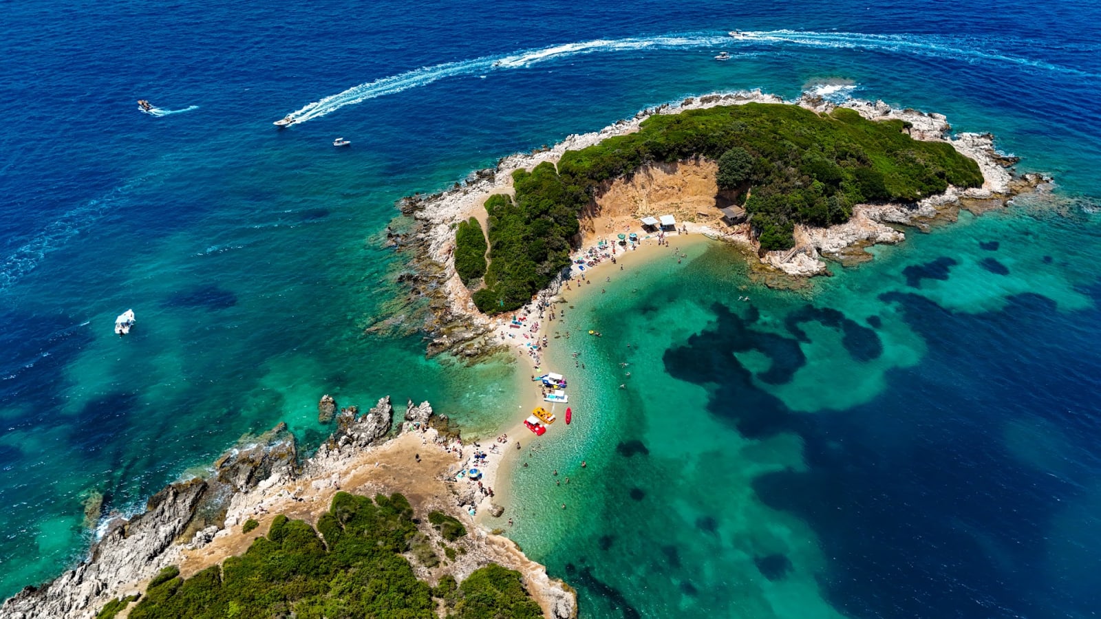
Butrint National Park was established on 2 March 2000. Its mandate covers Lake Butrint and its lagoon, the Vivari Channel, the islands of Ksamil and the archaeological site, and the National Tourism Agency describes it as reaching from the village of Berdenesh in the north to Cape Stillo in the south. The wetlands were designated a Ramsar site of international importance on 28 March 2003, and the National Agency of Protected Areas gives the park's current area as 8,622.2 hectares under a government decision of January 2022.
The lake is a salt lagoon about 7.1 km long and 3.3 km wide, up to 24.4 metres deep, fed partly by fresh water and partly by the sea through the channel. The protected areas agency records about 247 bird species in the park, some 70 per cent of them waterbirds, along with 105 species of fish, and says dolphins and loggerhead turtles use the coastal waters.
For the view over all of it, the Lake Butrint Viewpoint is a timber deck on the wooded ridge between Ksamil and the ancient city, looking down over the salt marshes to where the lake meets the channel. The islands at the other end of the park are covered in the guide to the beaches of Saranda and Ksamil.
Getting there from Saranda
The road south from Saranda runs past Ksamil to the park entrance. It was first built in 1959 for a visit by the Soviet leader Nikita Khrushchev and was upgraded in 2010. There is no need for a car, and several ways to go.
The public bus leaves from the Saranda to Ksamil and Butrint Bus Stop on Rruga Skënderbeu in the town centre. The line, whose timetable boards carry the crest of the Municipality of Sarandë, calls at Hotel Butrinti, Hotel Oasi, the Planet supermarket, the Çukë channel and Ksamil before Butrint, and the printed timetable at the stop lists departures from Saranda in one column and return runs from Butrint in the other. Check it at the stop the day before.
Taxis are the other independent option. The Butrint Foundation advises agreeing the return trip with the same driver, because a taxi can be hard to find at Butrint. Taxi Saranda Shehaj and QuickRide Saranda both run Butrint among their private tours, and Taxi Altin & Tours runs day tours to Butrint and Ksamil. For a set programme, Class Tours runs a daily return line from Saranda to Butrint with about two hours on site, and the sightseeing tours and tour agencies sections list longer days that pair Butrint with Ksamil or the Blue Eye.
The theatre and the sanctuary
Start with the theatre. UNESCO singles it out among the ancient Greek monuments at Butrint and describes it as fairly well preserved. By the 4th century BC the town had a theatre, a sanctuary of Asclepius, the god of healing, and an agora, and the Butrint Foundation describes the walled settlement of that time as a cult site of Asclepius. After the Roman colony was founded, new buildings went up around the theatre and the temple.
The theatre is notable for the number of inscriptions carved on its stones. Most record manumissions, the freeing of slaves, and they give a great deal of detail about the town in the Hellenistic period: the names of the freed slaves are almost all Greek, with a few Latin exceptions. Italian archaeologists under Luigi Maria Ugolini excavated the theatre in the years after 1928, in the first modern digs at Butrint.
UNESCO lists rising seasonal water levels among the site's vulnerabilities, and the area of the theatre and the Roman forum can sometimes be covered with water. That is why the orchestra floor can hold a pool.

The baptistery
The baptistery is the major early Christian monument at Butrint, and UNESCO describes it as a Roman building adapted to the needs of Christianity. It was built in the 6th century inside an earlier Roman bath complex, and it reused the baths' underfloor heating to warm the water for baptism. It was one of the largest early Christian buildings of its type.
The building is circular, 14.5 metres across, and two concentric rings of eight columns of Egyptian granite once carried a wooden roof. The capitals were carved with acanthus leaves and crosses, and the font sat at the centre of the round hall.
Its floor carries one of the site's great mosaics, laid in seven circular bands around the font. Peacocks flank a wine vessel from which vines grow, and stags drink at a fountain, an image taken from the 42nd Psalm; around them, roundels hold birds, sea creatures and domestic and exotic animals, some in hunting scenes. The baptistery was excavated in May 1928 by Ugolini's Italian mission.
The Great Basilica
On the north-eastern side of the town stands the Great Basilica of Butrint, built in the first half of the 6th century, when Butrint had become the seat of a bishop. Its standing walls outline the building, and UNESCO notes that the ruins are well enough preserved to show the plan: three naves, a transept and a polygonal apse on the outside.
The church had a long working life. It was rebuilt in the 9th century under Byzantine rule, and restored again after Charles of Anjou took control of both Butrint and Corfu in 1267, when a Latin bishop sat here.
The basilica is one stop in a dense late antique and medieval town. Nearby, the Triconch Palace was the house of a leading local figure, built around 425, and a church stood by the Lake Gate in the 9th century. Tours give the site a good while: the Joel Travel & Tours loop spends about 100 minutes among the Triconch Palace, the baptistery, the basilica, the walls and gates and the acropolis.

Walls and gates
Butrint's walls tell its history in layers, and UNESCO notes that they bear witness to the different stages of construction from the Greek colony to the Middle Ages. The acropolis was protected by three circuit walls. The last and outermost went up around 380 BC, 870 metres long with bastions and five gates, enclosing about four hectares.
The Italian excavations uncovered two of the gates, the Lion Gate and the Scaean Gate, which Ugolini named after the gate of Troy in Homer's Iliad. The walls were rebuilt extensively at the end of the 5th century, perhaps under the emperor Anastasius, and strengthened again in the Byzantine and Angevin periods as the despots of Epirus and later the Ottomans attacked.
The walls stayed in use as the town shrank. Excavations in the western defences show that they burnt down in the 9th century and were then repaired, evidence that life went on inside them.

The acropolis and the museum
On the acropolis the Venetians built a castle on the highest point of the hill shortly after they bought Butrint from the Angevins in 1386. It was abandoned in 1572 during the wars between Venice and the Ottomans, and Ugolini later restored it. It now houses the Butrint Museum, first opened in 1938, and the acropolis overlooks Lake Butrint.
The museum was closed from 1991 and lost objects to theft in 1997, and it reopened after renovation in 2005 with finds from the joint excavations of the Albanian Institute of Archaeology and the Butrint Foundation that began in 1994. The statues of Apollo and Artemis stolen in 1997 came back in 2008.
About 1,300 objects are arranged in date order, from prehistory to the Venetian period, in stone, bone, pottery, glass, sculpture and coins, with finds from the countryside around Butrint as well. Among the sculpture are portrait busts of Augustus, Livia and Agrippa and a statue of Dionysos from the city's nymphaeum.
The Vivari Channel and the Triangular Castle
Below the acropolis runs the Vivari Channel, which links Lake Butrint with the Straits of Corfu and forms the edge of the Butrint peninsula. The water flows both ways, turning about every six hours, from the lake to the sea and back on the rising tide, which is why the lake is partly fresh and partly salt. A pontoon sits near the park gate.
On the southern bank stands the Venetian Triangular Castle, a fort whose walls form a triangle in plan. Venice built it to protect the fish traps in the channel, a vital source of food and income, and when the acropolis was abandoned in 1572 the administration of Butrint moved to this small fortress. Butrint's fisheries were an important part of the supply of Corfu.
The Ottomans took the fort in 1655 and again in 1718, and each time Venice took it back. After the fall of Venice, Butrint passed to France in 1797, and in October 1798 Ali Pasha of Tepelena took the area, which remained Ottoman until Albanian independence in 1912.

Ali Pasha's castle at the mouth of the channel
The last fortress in Butrint's story stands where the channel meets the sea. UNESCO records that at the beginning of the 19th century a new fortress was added to Butrint's defences at the mouth of the Vivari Channel, built by Ali Pasha, the Albanian Ottoman ruler who controlled Butrint and the area until its final abandonment.
Ali Pasha's Castle began as a fortified estate house of the Gonemi family, Corfiot landowners who farmed the plain south of Butrint, and it appears on a map of around 1781. Ali Pasha took it over around 1804, added gun batteries and rebuilt it, and used it as a secondary residence until 1820. It keeps three towers and thick walls, looking out over the Straits of Corfu about 2.4 km west of the ancient city.
The castle is reached by boat. From Ksamil, SeaSun Boat Tours includes it on its hourly and full-day trips and runs fishing trips inside the Vivari Channel, and Poda Water Sport runs trips to it as well. From Saranda, Kedrik Water Sport runs guided jet ski trips to Butrint and Ali Pasha's castle.
Tours & Day Trips in Saranda
Boat trips, day tours and tickets around the town and the southern coast, via GetYourGuide.

Guided Walk Round Butrint
Two hours on foot with a guide through Butrint's Greek, Roman and Venetian remains, meeting at the park entrance.
Check availability
Private Butrint Visit with a Local Historian
A private visit with a historian guide, with the drive down the Ksamil peninsula, air-conditioned transport and park entry included.
Check availability
Butrint in Depth with a Traditional Food Tasting
Pick-up in the Saranda area and a specialist guide through the theatre, baptistery and Venetian towers, then Albanian food to taste.
Check availability
Butrint, the Blue Eye and Lëkurësi in a Day
Pick-up in Saranda or Ksamil for Butrint and the Blue Eye with both entry tickets included, ending at Lëkurësi Castle.
Check availabilityPlanning the visit
Opening times and ticket prices are set by the park and are not given here, so check them before you go. Go early in the day: the walk round the ruins and up to the acropolis takes time, and Butrint draws day-trippers from Corfu as well as visitors staying on this coast. Allow time for the museum on the acropolis.
The park is a protected area, and the wetlands are part of the visit as much as the ruins: bring binoculars if birds interest you. For food on the way back, The Mussel House sits on the shore of Lake Butrint on the road between Saranda and Ksamil, serving mussels from its own farm, which dates to 1998, and running boat tours of the mussel beds.
Butrint pairs naturally with an afternoon on the beaches of Ksamil, which is on the way back to Saranda. For the rest of the south, the day trips guide covers the Blue Eye, Gjirokastër, Phoenice and Corfu, and the one day in Saranda guide covers the town itself, from the synagogue ruins to Lëkurësi Castle.